c. 15–10 BC: Roman Barcino is founded
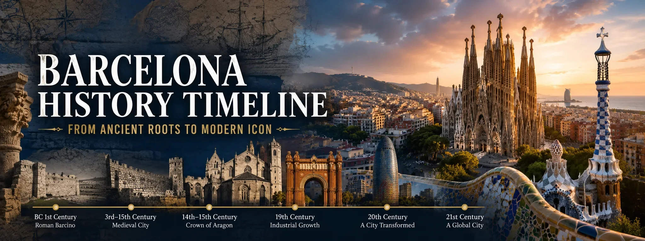
Barcelona’s documented urban story begins with the Roman colony of Barcino, founded in the Augustan period around 15–10 BC. It was much smaller than nearby Tarraco, but its walled grid occupied the high ground around today’s Gothic Quarter. The Roman city’s two principal streets crossed near the present Plaça de Sant Jaume, and fragments of the walls, temple columns, streets, workshops and domestic life remain embedded in the modern centre.
The best way to make this period real is the MUHBA archaeological route around Plaça del Rei. Beneath the square, preserved streets and industrial installations reveal a working town rather than an abstract Roman origin story. Elsewhere, temple columns survive inside the medieval street pattern. Barcelona’s later city repeatedly reused this Roman footprint, which is why the oldest centre still feels compact and layered.
10th–15th centuries: a medieval capital grows around the Mediterranean
After late-antique and early-medieval transformations, Barcelona became a major political and commercial centre in the medieval Crown of Aragon. Its urban fabric expanded beyond the Roman core into areas such as La Ribera, while trade connected the city to ports across the Mediterranean. Institutions associated with merchants and maritime law became part of Barcelona’s power.
You can still read that age in Santa Maria del Mar, the lanes of La Ribera, the royal complex around Plaça del Rei and the Gothic interior of La Llotja. The latter developed as a commodity exchange and trading centre from the 14th century. This was not simply a period of churches and palaces: commerce, craft production, water infrastructure and dense neighbourhood life shaped the city just as strongly.
1714 and the 18th century: defeat, military control and Barceloneta
The War of the Spanish Succession ended dramatically for Barcelona with the city’s fall on 11 September 1714. The Bourbon victory altered Catalan institutions and Barcelona’s political landscape. A huge military citadel was built on the eastern edge of the old city, requiring demolition and displacement in La Ribera. Archaeology at El Born preserves traces of the neighbourhood that existed before that transformation.
Barceloneta was laid out in the 18th century as a planned maritime quarter, including for people displaced by the military works. Its narrow blocks and relationship with the port are therefore part of the same historical story as El Born and the former citadel. Today the old citadel site is largely occupied by Parc de la Ciutadella.
19th century: industrial Barcelona breaks out of its walls
Barcelona became one of the Iberian Peninsula’s most important industrial cities, especially through textiles and related manufacturing. Factories and working-class districts transformed areas inside and outside the old walls. El Raval became heavily industrialised, while neighbouring towns such as Gràcia, Sant Martí, Sants and Sant Andreu developed their own urban and industrial identities before being absorbed into the growing city.
The medieval walls had become a severe constraint on population, sanitation and movement. They were demolished from 1854. That decision opened the way for an enlargement on a scale that permanently changed Barcelona.
1859–1860 onward: Cerdà and the Eixample
Ildefons Cerdà’s expansion plan imposed an extraordinary grid across the plain between the old city and surrounding settlements. The Eixample’s chamfered corners, broad streets and repeated blocks are now so familiar that it is easy to forget how radical the plan was. The enlargement gave Barcelona room to expand while providing a framework for transport, housing and modern infrastructure.
Reality diverged from some of Cerdà’s egalitarian and green-space ideals as blocks became more densely built, but the grid remains one of the clearest examples of 19th-century urban planning anywhere in Europe. Walking from the Gothic Quarter into Eixample is effectively a visible jump between two different ideas of what a city should be.
1888 and 1929: world exhibitions reshape public Barcelona
The 1888 Universal Exhibition focused development around the former citadel and helped turn the military landscape into Parc de la Ciutadella and a showcase of modern Barcelona. The Arc de Triomf, exhibition-era buildings and public realm around the park preserve that moment.
The 1929 International Exposition concentrated change on Montjuïc. Its monumental avenues, Palau Nacional, exhibition architecture and later cultural institutions helped define the hill as a civic and event landscape. These two exhibitions belong to a recurring Barcelona pattern: major international events being used to accelerate urban projects that remain long after the event itself.
late 19th–early 20th centuries: Modernisme becomes the city’s visual signature
Rapid industrial wealth, Catalan cultural revival and new architectural ambition converged in Modernisme. Antoni Gaudí is the best-known name, but Barcelona’s architectural identity also depends on Lluís Domènech i Montaner, Josep Puig i Cadafalch and many other architects, craftspeople and patrons.
Casa Batlló, La Pedrera, the Palau de la Música Catalana, Hospital de Sant Pau and the continuing Sagrada Família show different sides of the movement. MUHBA describes early-20th-century Barcelona as an industrial, modern and cosmopolitan metropolis whose rapid growth and social conflict coincided with the artistic explosion. Park Güell itself reflects that cultural and urban moment.
1900s–1930s: growth, labour politics and social conflict
Barcelona’s spectacular architecture existed alongside deep inequality and intense labour organisation. The city became a major centre of trade unionism, anarchism, republican politics and cooperative movements. Industrial districts and working-class neighbourhoods shaped political life just as much as bourgeois Eixample did.
The Second Spanish Republic began in 1931, followed by the Spanish Civil War in 1936. Barcelona experienced revolution, political violence, food shortages and bombing. Physical traces remain in air-raid shelters such as Refugi 307 in Poble-sec and in memorial sites across the city.
1939–1975: Franco dictatorship
Franco’s victory in 1939 brought dictatorship, repression and restrictions on Catalan political and cultural expression. At the same time Barcelona continued to industrialise and attract large-scale migration from elsewhere in Spain. Population growth outpaced housing and services in many peripheral areas.
Understanding post-war Barcelona means looking beyond the postcard centre: self-built neighbourhoods, workers’ movements, parish and community organisation, and later neighbourhood campaigns all influenced the democratic city that emerged after Franco’s death in 1975.
late 1970s–1980s: democracy and neighbourhood repair
Spain’s democratic transition restored elected local government and new forms of Catalan self-government. Barcelona invested in public space, neighbourhood facilities and urban repair. Small squares, parks, civic centres and street improvements were part of a broader strategy that treated public space as social infrastructure.
This period established much of the planning culture that later received international attention around the Olympic transformation. It also helps explain why apparently modest neighbourhood plazas matter so much to the city’s identity.
1992: the Olympics reconnect Barcelona with the sea
The 1992 Olympic Games were a sporting event, but their biggest visitor-visible legacy is urban. Major infrastructure and public-space works accelerated, Montjuïc gained and renewed venues, and the seafront was transformed. The Vila Olímpica was built on former industrial land in Sant Martí, while new beaches, housing, landscaping and public access helped reconnect the city with the Mediterranean.
This was not the creation of Barcelona from scratch — a common tourism cliché — but it was a decisive reconfiguration. The Olympic waterfront, ring roads and public realm made parts of the city function differently and strongly influenced Barcelona’s international image.
21st century: tourism, innovation, housing pressure and the metropolitan city
Barcelona entered the 21st century as a globally recognised destination, design centre and Mediterranean business city. Former industrial districts such as Poblenou have been reshaped by the 22@ innovation district, while metropolitan transport and public-space projects continue to alter how residents use the city.
Success has also created difficult trade-offs. Tourism pressure, housing affordability, climate adaptation, public-space use and the balance between local life and visitor demand are now central political questions. A responsible visitor should see Barcelona not as a finished museum of Gaudí and Gothic lanes, but as a living city still negotiating the consequences of its own popularity and growth.
For visitors, this history is especially visible in Gràcia and Sarrià, where old squares, parish centres and narrower streets interrupt the geometry of the expanded metropolis. District identity in Barcelona is therefore not just marketing language: many neighbourhoods retain memories of once being separate communities.
The Eixample did not grow into empty countryside forever. It eventually met older independent municipalities with their own centres, industries and identities. In 1897 Gràcia, Sant Martí de Provençals, Sants, Sant Andreu, Sant Gervasi and Les Corts were annexed to Barcelona; Horta followed later. Those former towns still explain why Barcelona feels polycentric rather than like one uninterrupted central grid.
1897 and after: surrounding towns become part of Barcelona
How to read the timeline while you walk
For the Roman and medieval layers, start around Plaça del Rei, the Cathedral and the former Roman walls, then continue to El Born and Santa Maria del Mar. For the 18th-century military and maritime story, link El Born, Parc de la Ciutadella and Barceloneta. For industrialisation and the Cerdà expansion, walk from Raval or Sant Antoni into Eixample.
Modernisme is clearest along Passeig de Gràcia and around Sagrada Família and Sant Pau. Montjuïc ties together the 1929 exposition, Civil War memory and 1992 Olympic legacy. Vila Olímpica and Poblenou then carry the story into post-industrial and contemporary Barcelona. Seeing these areas in sequence turns the city from a collection of landmarks into a coherent urban history.
Primary and authoritative sources checked
This guide was refreshed against the Barcelona History Museum (MUHBA) Roman Barcino route, MUHBA material on metropolis and Modernisme, current Barcelona Tourism history of Ciutat Vella, and official visitor material on Vila Olímpica and the 1992 waterfront transformation. Historical interpretation can be complex; museums and memorial sites are the best next stop for any period you want to explore in depth.